France is a unique country. Almost everything about France is attractive. Think of beautiful cities, and villages; incredible food and wine; breathtaking architecture; stunning beaches on three coasts; and the natural landscape of each region. Surely you are spoilt for choice when it comes to things to see and do in France.
We have looked at Regions in France and French Landmarks in our previous posts, and today we are going to cover something else equally fascinating – mountains in France.
Mostly when people think of mountains in France, it is the Alps and especially Mont Blanc that inevitably cross their minds, but there are seven French mountain ranges, each with its own character and delights.
Mountain Ranges of France
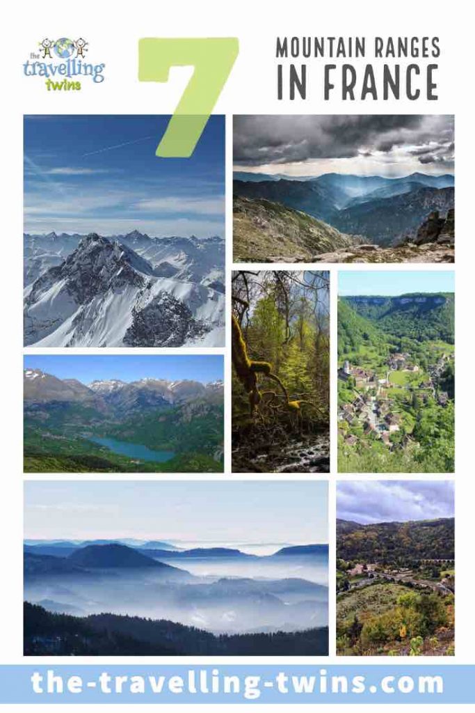
The French Alps
Lying in the south east region of France, The Alps comprise France’s borders with Switzerland and Italy and is home to the highest peak in the country and the whole of Western Europe. Mont Blanc stands at 4,808m (15,774 feet) above sea level and was first scaled by Jacques Balmat and Michel-Gabriel Paccard in 1786. Mont Blanc is not only one of the natural landmarks in France but as well in Europe.
The Alps mountain range contains France’s most resorts for ski touring with heavy reliable snowfall stunning scenery and both traditional skiing areas and opportunities for off-piste runs. They also cater to summer activities in mountain valleys forests and rockfaces.
The Chamonix Valley is located on the foot of Mont Blanc. There you will find a paradise for winter sports and is also a popular stop on the Tour de France route. It is also the site of the Aiguille du Midi cable car.
The summits of the Northern Alps are famous for winter sports, having staged three Winter Olympics Games. It is here in the Northern Alps that you will also find the best skiing areas including Tignes, Les Trois Vallees, Val d’Isere Les Arcs, and La Plagne.
On the other hand, the Southern Alps, with 300 days of sunshine every year and are home to the Ecrins parks, Mercantour National Park, and Vanoise National Park, all of which offer myriad summer options for anyone looking for a great hiking route and others, giving prominence to activities including trekking amongst pine trees, climbing, and kayaking.
Besides the many resorts, there are also a number of small, ancient towns and hamlets such each with its own mountain character and culture.
The Alps are among the most famous and well-known mountain ranges on the planet. They span eight countries including Slovenia in the east; Liechtenstein, Switzerland, France, and Germany to the west; and Monaco and Italy to the south.
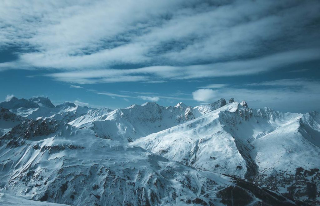
Massif Central and the Auvergne
Clad in forests and moorland and carved by lakes and rivers, the volcanic uplands of the Massif Central (located in central France) are home to just a handful of towns other the vast industrial city of Clermont-Ferrand, known for being the headquarters of Michelin.
This plateau is believed to be the geologically oldest part of France and covers almost 15 percent of the entire country. It is a tilted section of the planet’s tectonic crust and is scarred by faults including the great chain of extinct volcano peaks such as the”Chaîne des Puys” forming a basalt range, in the Auvergne region.
The Massif Central consists of four main volcanic massifs – the Monts Dore, the Chaîne des Puys, the Volcanic Velay, and the Monts du Cantal. The highest peak in the region is the Puy de Sancy, rising up to 6,184 feet.
The southwestern edge of the Massif Central is different from the rest of the massif. The altitude changes dramatically and the wild, desolate moorland of the Aubrac is cut by the picturesque valleys of the Lot and Truyere rivers.
Auvergne
Within the Massif Central mountain ranges, you will find the Auvergne Volcanoes National Park, which is not only the oldest regional park but also the largest. The park runs from Clermont Ferrand in the south, Aurillac in the west, and near St-Flour in the east.
The Auvergne is not one of France’s most popular tourists destinations, but it is still worth your time with its great river valleys, rolling hills, and forests. The region is ideal for hiking, bird watching, cross-country skiing, cycling, and even fishing. Super Besse is the only main ski resort in the area and serves as a link to Mont-Dore.
Speaking of rivers, Auvergne is home to some of the greatest rivers in France, including the longest river the Loire as well as the Sioule and the Cher.
There are also plenty of attractions in this region to discover, including the incredible array of flora and fauna and a culture that offers a remarkable history about the region.
Vulcania Amusement Park is focused on the discovery of volcanoes and our planet. It is an ideal place for young kids and students to enjoy discovering the secrets and fun facts about vulcanology.
Another place of interest within the Auvergne Mountains is the volvic water source. The volvic water comprises snow and water that fell on the volcanic park in the Auvergne. This water takes many years to pass through the mineral-rich rock layers before it is bottled. Here you can learn about the geological provenance of the water with a short trip to the Volvic information facilities.
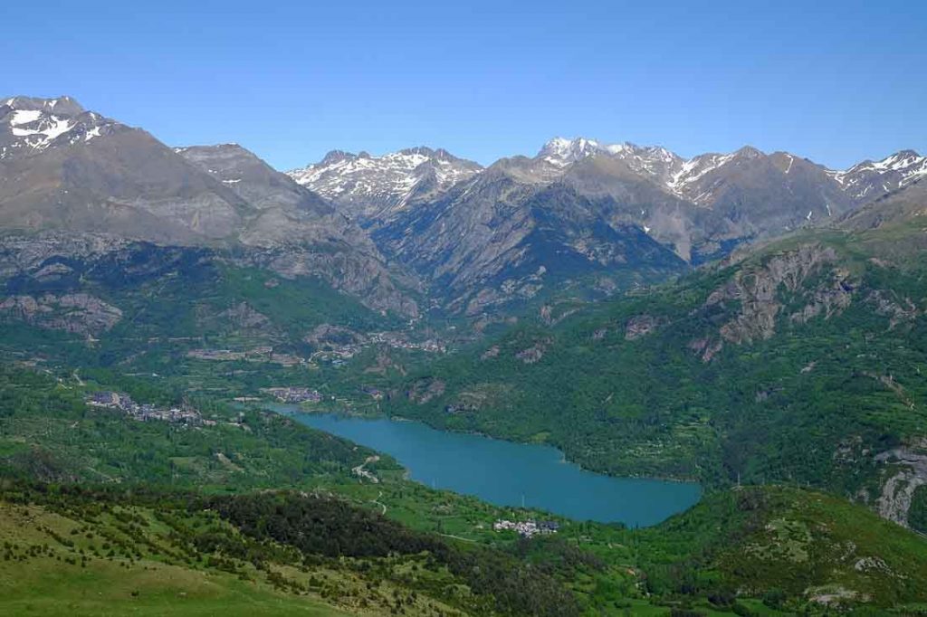
The Pyrenees
The Pyrenees Mountain range stretches from the Atlantic Ocean to the Mediterranean coastline in the south of France, marking the border with Spain and Andorra. They cover more than 270 miles and their widest point is 80 miles and their highest peak Aneto 3404m (11,169 feet).
Each end of the range has its own unique cultural composition. On the eastern edge of the Mediterranean, it is predominantly Catalan-speaking while the western region is mainly Basque-speaking.
The southwest edge of the range, which is known as the Languedoc-Roussillon or Cather country, is where the Cather heretics resided and hid before they were destroyed by the French crusaders in the 13th century. The Montsegur castle is known for being the last place the heretics made their final heroic stand.
For hikers, the Parc National des Pyrenees below the Aspe Valley is the place to be. The area includes a number of short paths through the Pyrenees, one of them being the GR 10, which runs from one coast to the other.
One of the most popular points in the Pyrenees is perhaps Pheasant Island. Tiny and uninhabited, this islet stretches some 200 meters long and 40 meters wide in the Bidasoa River. The river separates France and Spain, with the small island in the middle. From February to July, the island is in Spain and for the rest of the year, it is in France. This is a result of the Treaty of the Pyrenees that was signed between Spain and France in 1659.
Largest cities/towns in Pyreneese include: Perpignan, Lourdes, Pau, Biarritz, Bayonne, St Jean de Luz
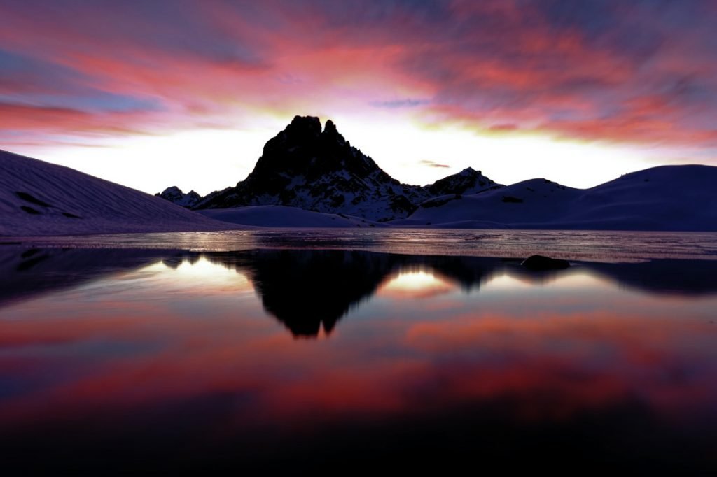
![]() Le Pic du Midi
Le Pic du Midi
The Pic du Midi is a mountain located in the French Pyrenees with an elevation of 9,439 feet. It is famous for being the site of the Pic du Midi Observatory.
The observatory is perched at 2,877 meters at the summit of the Pic du Midi de Bigorre and is part of the Midi-Pyrenees Observatory which has numerous other research stations in the towns of Tarbes, Auch, and Lannemezan.
There is a cable car that takes visitors up the mountain and can spend the night at the peak if they want. Of course, for an elevated site like this, sunset and sunrises, as well as star-gazing, are the fun things to do.
The Jura
The Jura Mountain range stretches more than 225 miles along with the French and Swiss border and from the River Rhone to the Rhine. The highest peaks are located in the south of the range around the city of Geneva, namely the Cret de la Neige in Ain at 1720m (5,636 feet) and Le Reculet at 5,633 feet.
It is one of the best-preserved places in France and a loved spot for tourists looking for hiking and cycling trails. There are plenty of signposted trails within the mountain range, such as the Jura ridgeway, which is 190 miles long.

Many people flock to this region to enjoy the sight of peaks such as the Chasseral, natural landmarks like Creux du Van, gorges such as Taubenloch, and caves such as Grottes de I’Orbe.
The twin towns La Chaux-de-Fonds are listed as UNESCO world heritage sites due to their horological and related cultural history.
Nices towns of Jura:Dole, Château-Chalon, Baume-les-Messieurs, Clairvaux-les-Lacs, Poligny, Arlay, Orgelet, Salins-les-Bains, Arbois, Nozeroy, Sellières, Arinthod.
The Vosges
Located in eastern France to the left bank of Rhine Valley is a range of low mountains near the border with Germany – Les Vosges. The Vosges is divided into three areas.
The Higher Vosges extends from the southern corner of the range in Belfort to the river gorge in Bruche. It features rounded summits, which are known as ballons (balloons) in French. The second section is called the Middle Vosges and it includes the Devonian-Dinantian volcanic peak of Schirmeck-Moyenmoutier and the Col de Saverne, and the last section is called the Low Vosges and located between the source of the Lauter and the Col de Saverne.
The highest peak in the Vosges is the Grand Ballon at 4,672 feet.
More than 60 percent of the Vosges is blanketed y forest and also includes two Regional Nature parks namely the Northern Vosges Regional Nature Park and the Ballon des Vosges.
Morvan Massif in Burgundy
Burgundy is known for its famous vineyards and its incredible cuisine. However, there is another section of the region that usually flies under the radar of tourists – the Morvan.
This granite massif is the closest mountain range to the capital Paris and can be reached via motorway.
The mountain range is covered with dense forest and dotted with beautiful lakes and streams of rivers. It is also the smallest of all the main French mountain ranges.
In 1970, the Parc Naturel Regional du Morvan was created, making the Morvan a protected area. The park covers around 430,000 acres and its highest point is Haut-Folin at 2,956 feet. It is home to some stunning hiking trails including a half-day gentle hike and tough walk around the entire range.
Corsica
The seventh of Frances mountain ranges is the only one not on the mainland. Corsica, known as the “island of beauty” is among the 18 regions of France. It is located in the Mediterranean, southeast of the French mainland and west of Italy. Corsica is the fourth largest Mediterranean island after Sicily, Sardinia, and Cyprus. It has a total of 472 peaks in a single range of mountains that covers approximately two-thirds of the island.
Of the 472 mountains, 20 are more than 6,560 feet high with the highest of them all being Monte Cinto at 8,878 feet. Monte Cinto (Monte Cintu) is also one of the most popular peaks in Europe as it offers both the panorama views of the island as well as distant mountains across the pond. One of the mountains visible from Monte Cinto is Monte Rosa, which is 15,203 feet tall and 252 miles away in Switzerland.
Island has only two main cities Ajaccio in south-west and Bastia on thenorth-east. Ajaccio is famous as the birthplace of Napoleon Bonaparte.
The mountain range in Corsica is home to one of the toughest and most prominent long-distance trails in Europe known as the GR20. The hiking trail passes through the island from north to south diagonally and across the mountain range, stretching some 112 miles with an elevation of 32,808 feet.
Mountains Ranges of France – Pin in


Privacy Policy Disclaimer
This website uses affiliate links for income and support.
If you like our website, please consider using these links. You will be directed to the vendor, and we will get a small commission on your purchase price at no increased cost to you.
We have researched facts stated here as far as practicable but please check anything critical before committing your time and money. We do not claim any special knowledge or expertise, and we are not consultants for our readers.